Digital
Mapping the Future: Scotland’s LiDAR Revolution
October 3, 2025 by Stewart Hamilton 2 Comments | Category Data, Digital Scotland, LiDAR (Light Detection and Ranging)
Guest blog by Mathew Williams, Scottish Government Chief Scientific Adviser for Environment, Natural Resources and Agriculture.
My name is Mathew Williams, and I have the privilege of serving as the Scottish Government Chief Scientific Adviser for Environment, Natural Resources and Agriculture. In this role, I help shape policy around our natural world by bringing scientific evidence to the heart of environmental decision-making—whether it’s about our landscapes, farming practices, or responding to climate change.
I am a practicing scientist, leading the Global Change Ecology Lab at the University of Edinburgh, where we study the state of our planet and try to understand its future and what that means for society. Our research explores how carbon, energy, and water move through both natural ecosystems and managed landscapes. It’s a complex puzzle, and we use everything from field data to satellite imagery and simulation models to piece it together.
I’m especially excited about the launch of Scotland’s new land LiDAR programme, which I’ll tell you more about in this blog. This cutting-edge technology will give us unprecedented insights into how land use affects environmental challenges such as climate change and nature restoration—helping us better understand and protect Scotland’s environment, and therefore the people of Scotland, for generations to come. This large-scale project has been possible with the support of funding from the Scottish Government, SEPA, Forest and Land Scotland, NatureScot, Scottish Water, and Scottish Forestry.
From Sketches to Scanners: The Evolution of Mapping in Scotland
Maps have always been one of humanity’s greatest tools—helping us understand our surroundings, navigate the unknown, and plan for what’s ahead. From ancient sketches to modern digital cartography, the journey of mapping has been one of constant innovation. In Britain, this journey was shaped by pioneers like William Roy, a visionary Scottish engineer whose work laid the foundations for the Ordnance Survey. Scotland’s mapping research legacy lives on in the contours and precision that define our maps today.
But now, a new chapter is unfolding—one that promises to transform how we see and interact with the land around us.
Enter LiDAR: A New Dimension in Mapping
LiDAR (Light Detection and Ranging) is a game-changer. Using lasers mounted on aircraft, it captures the landscape in astonishing detail—measuring height at centimetre-level resolution, 100 times more precise than traditional Ordinance Survey maps. It doesn’t just map the terrain; it sees objects too—trees, buildings, hedgerows.

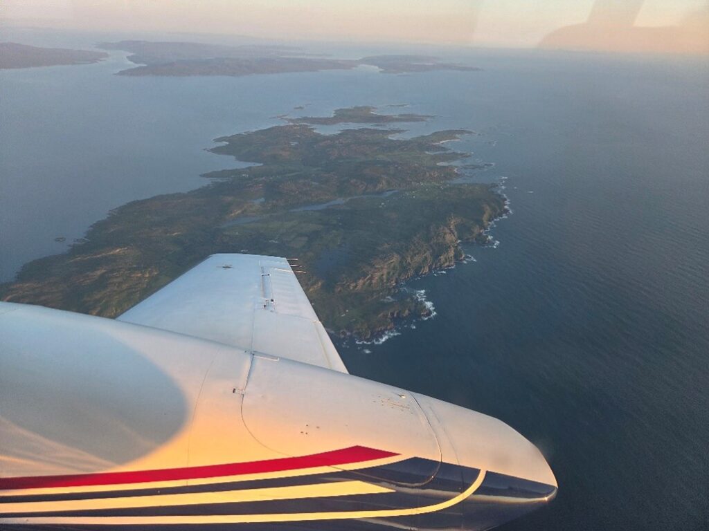
Our contractors flying the LiDAR plane flying over Islay this summer as part of our national land LiDAR programme. Image provided by: https://bluesky-world.com/
Imagine flying over Scotland and painting the land with billions of laser pulses. That’s exactly what the Scottish Land LiDAR Programme will do—more than 700 billion pulses over three years, starting in summer 2025. The result? A high-resolution, three-dimensional map of Scotland’s entire land surface at centimetre scale.

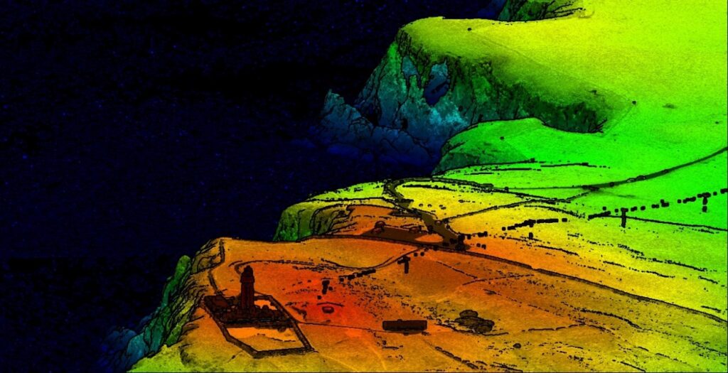
LiDAR analysed image captured from our lad LiDAR programme over the most Southerly point at the Mull of Galloway. Coloured by LiDAR intensity and elevation values. Image provided by: https://bluesky-world.com/
Why It Matters
This isn’t just about beautiful maps. It’s about unlocking new possibilities with the accuracy of LiDAR.
You likely use location services on your phone to help you make decisions every day. Linking highly accurate location data to LiDAR maps opens up exciting possibilities for people, businesses and government to understand their environment, and therefore plan and deliver a better future.
For farmers, LiDAR can pinpoint where in their fields rainwater erosion threatens soil. LiDAR can map their carbon stores, and where biodiversity thrives, by identifying hedgerows, wetlands, and trees outside woodlands—vital for conservation and land management.
For planners and engineers, LiDAR offers unparalleled insight into terrain, helping design infrastructure that’s resilient to climate change, or build new energy infrastructure in the most sustainable ways, conserving nature.
For environmental agencies, it supports flood forecasting, peatland restoration, and biodiversity monitoring. SEPA, NatureScot, Peatland ACTION, Forest and Land Scotland, and Scottish Forestry can benefit from LiDAR—from mapping our Atlantic rainforests and flood risk, to tracking forest carbon stocks and peatland condition.
Open Data, Open Possibilities
The Scottish Government is investing not just in data collection, but in making this data accessible. The Digital Directorate is working to release LiDAR data under an open licence, ensuring that researchers, businesses, and the public can use it freely. A new platform is being developed to support data sharing and collaboration.
This openness is key. It invites creativity. It encourages innovation. And it ensures that the benefits of LiDAR reach across sectors—from agriculture and transport to climate action and rural development.
Repeated LiDAR surveys, every 3 or 4 years, will allow us to track changes, and therefore evaluate our progress towards key goals, or determine where more work is needed.
A Collaborative Effort
The Scottish Land LiDAR Programme is the result of collaboration across government. The Rural and Environment Science and Analytical Services (RESAS) team and Digital teams have worked collaboratively with UK Government Digital Services, who have provided our mechanism for data collection through the Aerial Photography for Great Britain (APGB) Project.
As CSA for ENRA, I want to thank all those who have contributed to making this vision a reality. And I encourage everyone to think about and act on the creative possibilities that this new generation of mapping allows.
Professor Mathew Williams
Chief Scientific Adviser, Environment, Natural Resources and Agriculture
EnFor/ARE/DECC
Tags: Chief Scientific Adviser, Environment, LiDAR (Light Detection and Ranging), LiDAR programme, Natural Resources and Agriculture

Do you have a programme of when Lidar surveys will be carried out in Dundee area and when this will be publicly available?
We are doing our best to collect the whole of Scotland and need clear skies to ensure our flights can collect good data. This means we can’t say exactly when particular areas will be collected. Once an area has been collected it also takes time to prepare our final products before we release these on the remotesensingdata.gov.scot portal. We haven’t flown over Dundee yet but keep an eye out for future blog posts where we will be letting users know about data releases!