Marine
MarPAMM Project
May 13, 2019 by Marine Directorate Communications No Comments | Category Climate Change, Collaborations, Marine Directorate general, Marine Directorate Science, Marine Directorate Surveys, Marine Environment
MRV Alba na Mara Programme
Survey 0719A
Duration: 13-15 May 2019
Sampling Gear & Equipment:
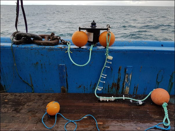
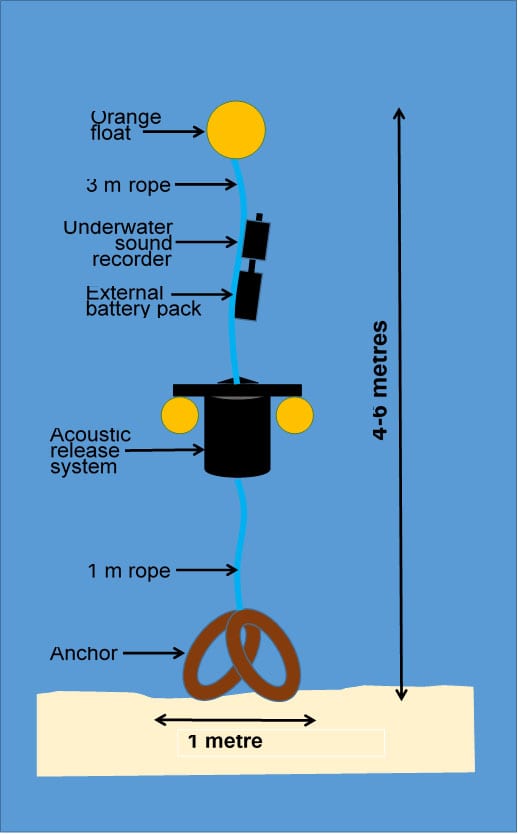
- 3 x marine mammal monitoring moorings to be deployed
- 80 kg clump weight
- Vemco VR2AR acoustic release
- Loggerhead DSG-ST sound recorder
- Chelonia C-POD
Overview:
Survey 0719A aims to deploy three marine mammal and underwater noise monitoring moorings at sites in Scottish waters, within the INTERREG VA “cross-border” region. Data are required to underpin the management of marine protected areas and protected species (marine mammals), to meet Marine Scotland’s commitments under the MarPAMM project.
Objectives:
To deploy three marine mammal monitoring moorings with acoustic releases. Indicative areas for these moorings are: N of Islay/SW of Colonsay (55⁰ 56’ N, 006⁰ 25’ W), SW of Tiree (56⁰ 26’ N, 007⁰ 06’ W), and E of Mingulay (56⁰ 48’ N, 007⁰ 36’ W) – these locations will be refined in due course. All moorings will be deployed in max. 120 m water.
Embarkation:
Scientists will join the vessel on 12 May in Oban and spend the night aboard, so that the ship can leave early on 13 May. Weather permitting and after all vessel drills have been undertaken, Alba na Mara will head SW to the first mooring site N of Islay. After deployment, the vessel will steam NW to the second mooring site SW of Tiree. On 14 May, the vessel will steam NW to the east side of Mingulay to deploy the third mooring. The work will then be complete. The precise order in which the vessel will undertake the survey work will be decided by the SIC in conjunction with the skipper. The vessel will anchor overnight at a safe anchorage to be advised by the skipper.
Daily operations will occur between 07:00 and 19:00 hours (all times BST). Scientific operations will cease on 14 May to allow sufficient time for the vessel to travel to Kyle of Lochalsh. Unloading will occur in Kyle on 15 May.
Normal contact will be maintained with the Laboratory.
Table 1: Locations and mooring names.
|
Location name |
Latitude |
Longitude |
Depth |
| Colonsay | 55⁰ 56’ N | 006⁰ 25’ W | TBC |
| Skerryvore | 56⁰ 26’ N | 007⁰ 06’ W | TBC |
| Mingulay | 56⁰ 48’ N | 007⁰ 36’ W | TBC |
Tags: acoustic releases, Alba na Mara, mooring, research vessels


Leave a comment