
Marine
MRV Scotia: Survey 1714S – Cruise Programme
October 29, 2014 by Marine Directorate Communications No Comments | Category Marine Directorate general, Marine Directorate Science, Research Vessel Surveys
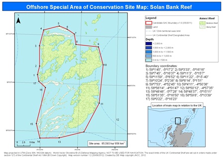
Figure 1 – Solan Bank SAC
Duration: 28 October – 10 November 2014
Gear:
- Sonardyne Scout Plus USBL
- Sonardyne omni-directional transponder
- TV drop frame with lasers, SEA LED lights and wiring harness
- Kongsberg 14-408 digital camera system (X2)
- Kongsberg 14-208 digital camera system
- Kongsberg 14-366 TV camera system
- SUBC 1-CAM Alpha HD camera system
- Net-sonde cable
- VMUX controller
- 450m polyurethane cable
- Seabird 911 CTD with fluorescence and turbidity sensors
- Hull mounted ADCP
Objectives:
The aim of the survey is to gather seabed evidence to inform development of a national indicator of ‘Good Environmental Status’ as part of the UK’s obligations under the Marine Strategy Framework Directive (MSFD). Solan Bank Reef is located approximately 50 km north of Cape Wrath on the Scottish mainland (see Figure 1).
The majority of the site lies in water depths of 60-80 m, however, to the south east of the site an outcrop of bedrock reef rises to approximately 20 m below the sea surface. The objectives of the survey are (listed in order of priority):
- To gather high resolution video and still images along transects and from quadrats throughout Solan Bank using a TV drop frame system (see Figures 2 and 3).
- To gather environmental data using a CTD (salinity, temperature, depth, fluorescence and turbidity) from the same area.
- To gather high resolution underwater video and stills data to update existing substrate maps of the site
- To log ADCP data (current speed and direction) from throughout the area of interest.
Procedure:

Figure 2 – Targeted Stations
After completion of safety drills and exercises, Scotiawill proceed northwards to the vicinity of the Southern Trench where gear testing will be undertaken. The vessel will then make passage to Solan Bank and commence sampling on the targeted sampling station grid (see Figure 2) and on the stratified random sampling stations (Figure 3).
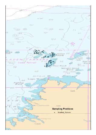
Figure 3 – Stratified Stations
The TV drop-frame with attached CTD will be deployed at each station allowing simultaneous logging of imagery and environmental data (temperature, salinity, fluorometry and turbidity). Surface salinity samples will also be collected from the water sampling lab as required.
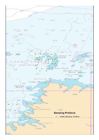
Figure 4 – Contingency Habitat Mapping Stations
ADCP data may be also be collected from positions within the survey boxes as illustrated in Figure 6, the actual latitude and longitude data for these stations will be provided while at sea. Depending on the severity of weather conditions and wind direction, further contingency sampling for SNH may be carried out as detailed in Figure 5.
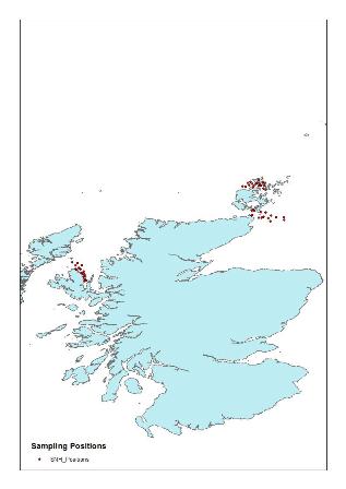
Figure 5 – SNH Contingency Stations
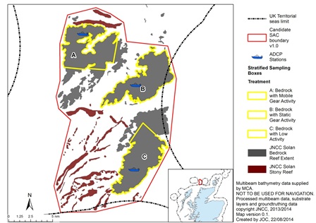
Figure 6 – ADCP positions within fishing activity boxes

Leave a comment