
Marine
Mapping the seabed of the north of Scotland
August 14, 2015 by Paul Stainer 3 Comments | Category Marine Directorate Science, Research Vessel Surveys
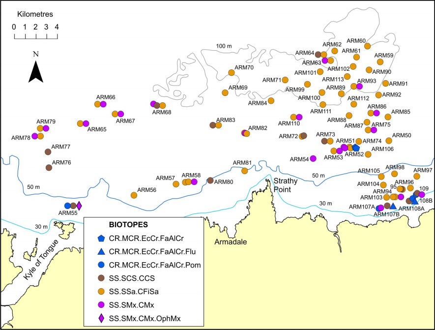
The bathymetry is complemented by a suite of photographs and video over the survey area which were collected using a drop-frame camera towed behind the research vessel. Analysis of these images has enabled determination of substrate and biotope from which we will be able to build a habitat map of the survey area. Habitats and species of conservation concern have also been identified.
The dominant habitat type throughout the survey area was rippled fine sand. The fauna was generally sparse, but shells resembling the priority marine feature. Arctica islandica were widely distributed in the deeper stations (> 70m). Sand waves made up of coarser substrates are widely distributed in the survey area. 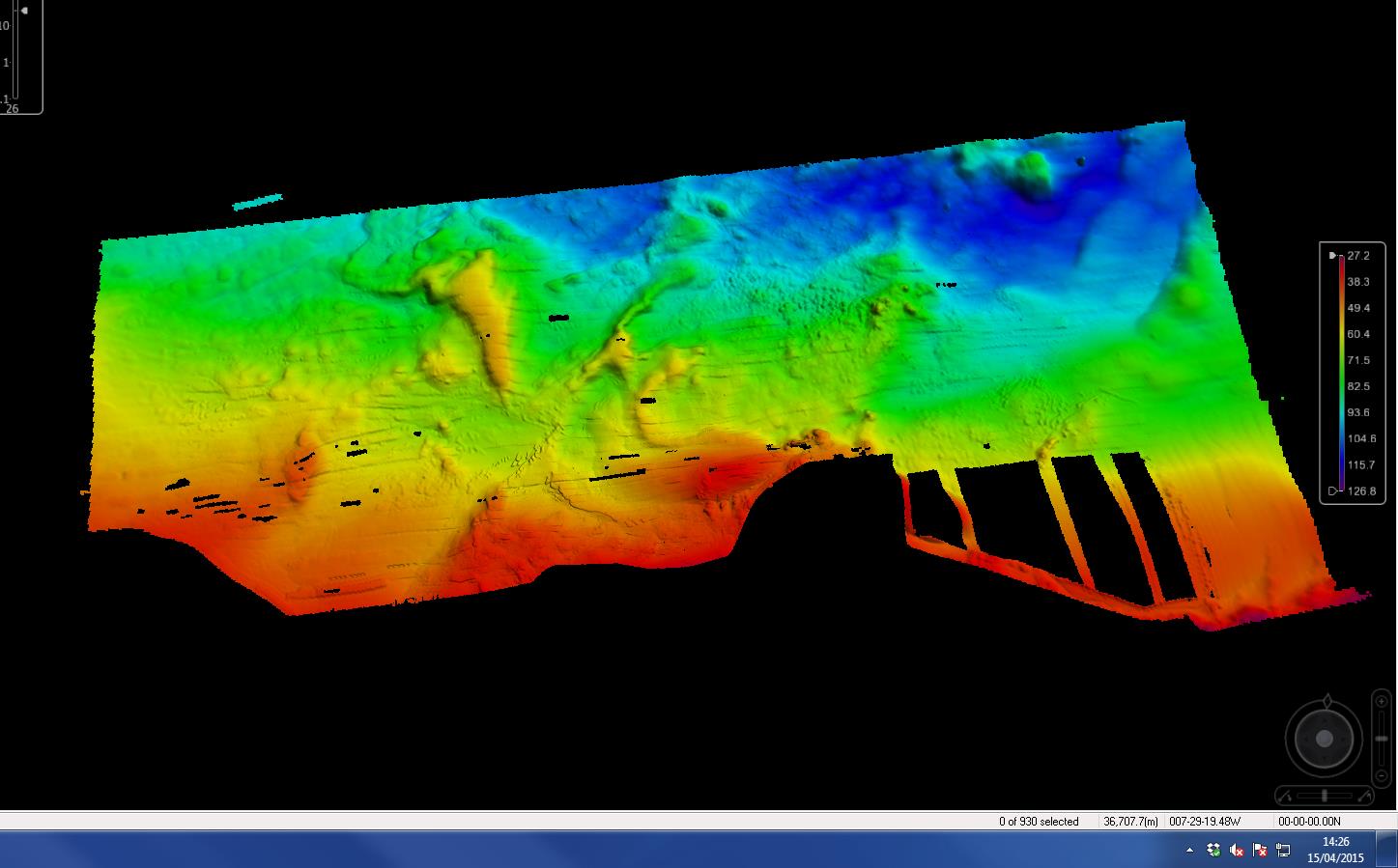 Rocky reef habitats composed of boulders and cobbles were found predominantly in shallower water (<45m).
Biotopes identified within the Farr Point survey area Scottish Natural Heritage Commissioned Report No. 819.
The bathymetric and photographic data can be downloaded on our website, Marine Scotland Interactive.

How much of Scotland’s seabed is mapped in this detail? It seems certain areas are (here, Rockall), but not the entirety of the 12nM territorial sea. Is this correct? Are there any current projects looking at doing more mapping?
I am looking at writing a piece about habitat impact quotas for dredgers/trawlers and was wondering what is and is not mapped in sufficient detail to inform decisions.
I’ll try to find out for you, Erin.
Hi Erin. The honest answer would appear to be that not much is mapped!
However, I’ve got some links that might be useful for you:
– the UKHO portal http://aws2.caris.com/ukho/mapViewer/map.action shows where there are INSPIRE data sets (i.e. good quality data) for Scotland’s seas but these are quite limited – just turn on bathymetry to see that information.
– the UK Civil hydrography programme survey areas 2017: https://www.gov.uk/government/uploads/system/uploads/attachment_data/file/598709/CHP_SurveyPlans_2017.pdf which gives information on completed (2004 to 2016) and planned UK Civil Hydrography Programme (CHP) surveys (up to 2020).
– the UKHO Admiralty chart that shows the status of surveys: https://www.gov.uk/government/uploads/system/uploads/attachment_data/file/598293/Q6090_2017_March.pdf for United Kingdom British Isles hydrographic survey status to March 2017.
Lastly, there are two other information portals: http://marinescotland.atkinsgeospatial.com/nmpi/ (which contains what is known as GeMS data – habitat, species and geodversity spatial information) and http://www.emodnet.eu/ which has bathymetric information.
I hope that helps and if you need anything else, please email marinescotland@gov.scot