
Digital
MUDDI – A new standard for underground data
February 1, 2022 by Stewart Hamilton No Comments | Category Data, Digital Scotland
Blog by Alexander Ramage, Head of Management Information Systems, Transport Scotland.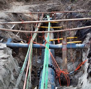
My name is Alexander Ramage and I work in Transport Scotland as Head of Management Information Systems. As part of my role I work with the Data Standards Team in Digital Directorate as the Scottish Government representative to the Technical Committee of the Open Geospatial Consortium.
The Open Geospatial Consortium is an industry body with membership of individuals and organisation from around the world that considers Geospatial issues and identifies appropriate standards to support the resolution of these issues. The coverage of the international standards that they produce range from, Metadata catalogue (sharing of information), visualisation and downloading services for data, to building specialist extension of other standards to meet a specific need. (The extension of the XML standard to allow for the descriptions of a City called CityGML).
This blog describes the work on the MUDDI standard (Model for the Underground Data Definition and Integration).
What problem is MUDDI trying to solve? Every year the vast majority of seemingly routine street excavations occurring around the world can be adversely impacted by lack of usable information about buried utility infrastructure. We have all lost access to utility services at some point as “someone dug through a cable or pipe”. Why does this happen? one reason is there is no common, well understood mechanism for holding information about underground apparatus in an interoperable manner.
In Scotland, we have implemented VAULT, a tool for the Roads and Utility industries that provides a shared platform on which the underground (and some above ground) data is stored and can be queried. In the rest of the UK, there is currently no similar system, but the Geospatial Commission have just completed a Pilot project for NUAR (New Underground Asset Register) and are in the process fully implementing a similar system.
So MUDDI, is considering 3 main use cases that it is trying to solve.
• Excavation – Understanding where artefacts are to avoid the issues digging something up accidentally.
• Environment
• Disaster
Work is progressing well on the excavation use case, with a draft data model now coming together. Work on the second of the use cases has started, this will use the draft model developed so far and extend it as required. Work on the last use case will start once the majority of the Environment use case is complete.
Although Scotland has implemented something that meets the specific needs of the Roads and Utilities industries there is no current standard for Roads and Utility organisations to provide their information to VAULT in an interoperable manner. Each information source has to be “manually” set up for import to VAULT. While meeting the needs of the VAULT system the bespoke nature of the data supplied prevents this data from being used in other systems.
I am working to ensure the MUDDI model is capable of being used in Scotland for VAULT. Once the MUDDI model is capable of describing apparatus above ground as well as underground the VAULT system would be able to accept data using this model.
The MUDDI standard, when complete, will establish a data model for exchanging information that conforms to the FAIR principles, specifically the Interoperable and Re-usable elements.
The acronym FAIR stands for: F (Findable), A (Accessible), I (Interoperable) and R (Reusable).
For more information on MUDDI, please feel free to contact me: alex.ramage@transport.gov.scot
Tags: Data, excavation, infrastructure, MUDDI, underground, utility
Leave a comment