
Marine
MRV Scotia: Survey 1215S Programme
August 20, 2015 by Marine Directorate Communications No Comments | Category Compliance, Marine Directorate general, Marine Directorate Science, Research Vessel Surveys
Duration: 5-16 September 2015
Fishing Gear: BT 184 Deepwater trawl with 16“ ground-gear and Morgere 1700 kg doors (monkfish)
Other Gear: Groundgear Bosom bag for BT184
Objectives:
- To map the composition, distribution and abundance of continental slope species including invertebrates on the deepwater slope west of the Hebrides and Rosemary Bank to depths of 2000 m;
- To collect temperature at depth during all deepwater hauls using a data storage sensor attached to the trawl headline;
- To collect samples (genetics and otoliths) for key species for population studies and undertake any other sampling requests, e.g. MSFD litter recording;
- Continued use of groundgear bag on selected stations to further evaluate gear catchability of deepwater fish species at different depths as well as providing valuable benthic data.
Procedures:
The deepwater slope survey will depart from Ullapool on the morning of 5 September and proceed south through the Minch to the first trawling station on the shelf slope between 500-2000 m within statistical rectangle 41D9. The primary objective is to map the composition, distribution and abundance of fish species on the deepwater slope west of the Hebrides (Figure 1, southern two tow positions are provisional). Trawling will mainly be at fixed stations at depths of 500, 750, 1000, 1500, 1800 and 2000 m, although additional trawls may be undertaken at intermediate depths within selected transects. Trawl duration will typically be one hour and the locations of trawling stations will be provided to the vessel at the commencement of the survey.
In addition daily meetings with take place between the fishing master, captain and the SIC to discuss and refine the survey plan as the survey progresses. No CTD deployments will be made, rather a DST (data storage tag) will be deployed onto the trawl headline for the duration of the survey and will provide bottom temperature data for all of the trawls undertaken during the survey. Trawling will be conducted within the hours of daylight. It may on occasion be necessary to trawl at night although it is accepted that this will be the exception rather than the norm and night time will mainly be spent in passage from one sampling area to the next. From all tows the entire catch will be sorted, weighed and length-frequency data collected for all fish species encountered. Benthic invertebrate by-catch will also be recorded. On selected tows a ground gear bag will be attached for benthos sampling. Additional biological sampling to be carried out on selected species.
Figure 1: 1215S – Shelf slope with approximate position of survey trawl transects.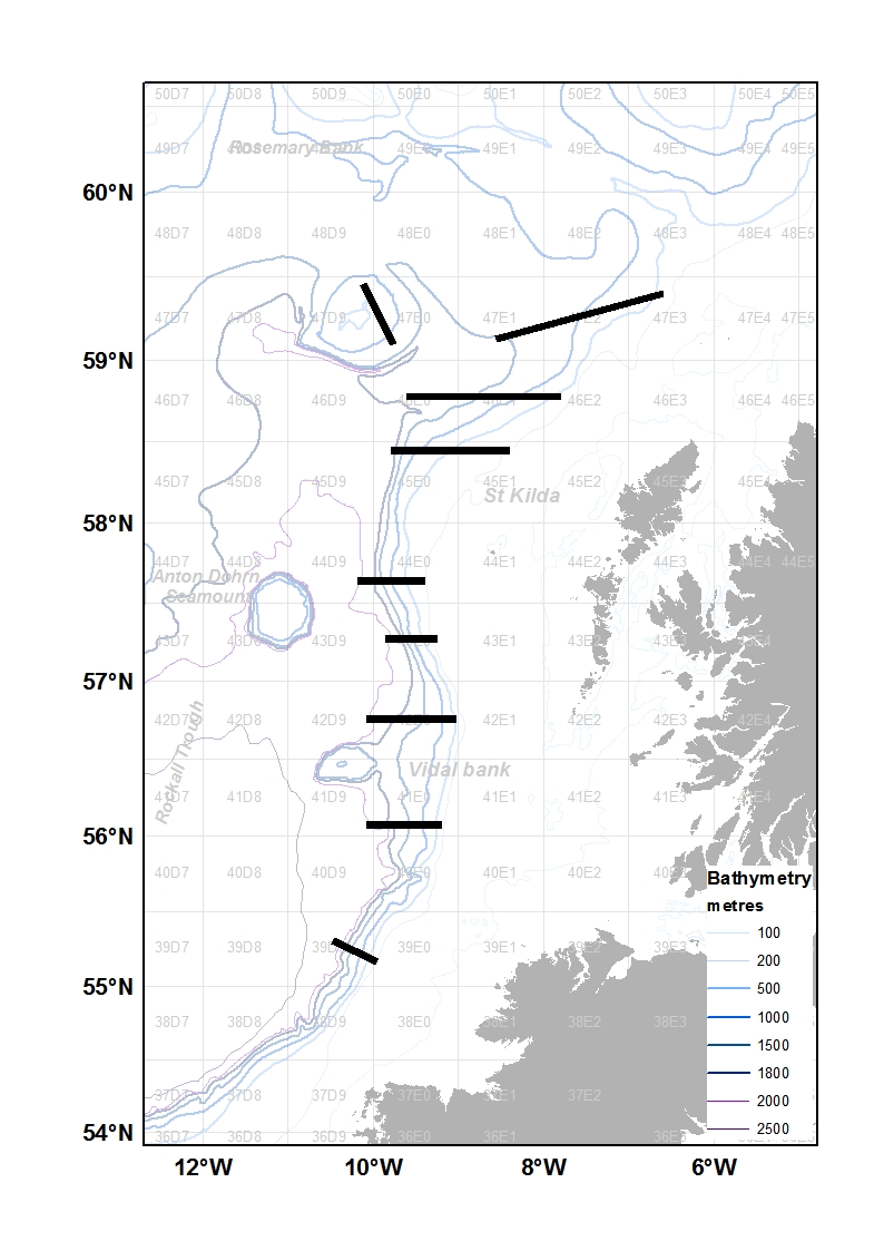

Leave a comment