
Marine
SACs of Sponges
September 3, 2018 by Marine Directorate Communications No Comments | Category Marine Directorate general, Marine Directorate Science, Marine Directorate Surveys, Research Vessel Surveys
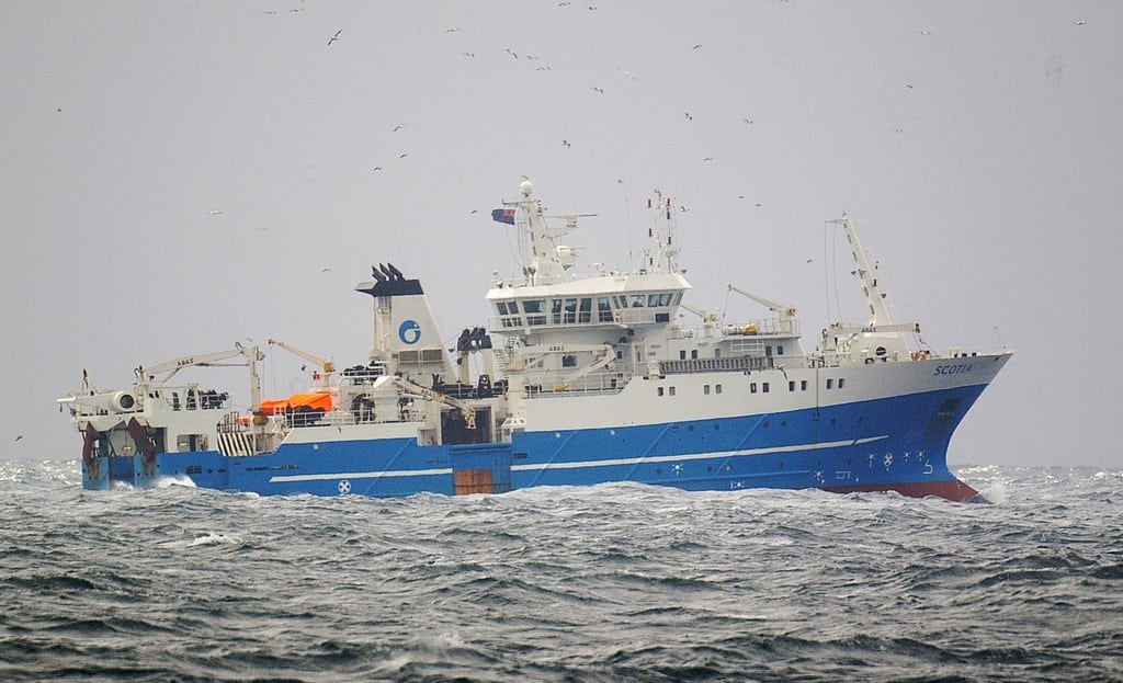
Survey: 1218S MRV Scotia
Duration: 21 August – 15 September 2018
Introduction: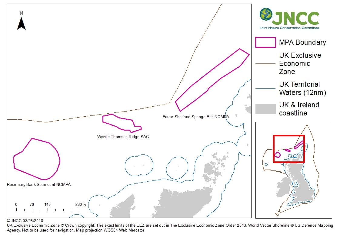
This survey programme outlines the monitoring survey requirements, following discussion between the Joint Nature Conservation Committee (JNCC) and Marine Scotland Science (MSS), for three Marine Protected Areas (MPAs) in Scottish waters which are:
- Faroe-Shetland Sponge Belt NCMPA (FSSB),
- Wyville Thompson Ridge SAC (WTR), and
- Rosemary Bank Seamount NCMPA (RB).
Nature Conservation Marine Protected Areas (NCMPAs) and Special Areas of Conservation (SACs) are designed to meet conservation objectives under the Marine (Scotland) Act (2010) and EC Habitats Directive (1992) respectively. These sites will contribute to an ecologically coherent network of Marine Protected Areas across the north-east Atlantic.
Main Objectives:
Faroe-Shetland Sponge Belt:
1. Measure rate and direction of long-term change (type one monitoring) using VMUX towed video chariot and Drop-frame fitted with high definition cameras.
2. Update and extend coverage of previous demersal trawl time series in vicinity of FSSB.
3. Obtain samples of sponge community from FSSB for classification, molecular studies, identifications, and to provide baseline data on hydrocarbon levels in FSSB sponge tissue.
Rosemary Bank Seamount:
4. Measure rate and direction of long-term change (type one monitoring) on north, east, and south slopes of RB using VMUX and Drop-frame fitted with high definition cameras.
5. Update demersal trawl time series on RB on historical stations between 600-1100 m depth plus another at 2100 m, time permitting.
6. Obtain samples of sponge community for classification, molecular studies, identifications, and to provide baseline data on hydrocarbon levels in RB sponge tissue.
Wyville Thompson Ridge: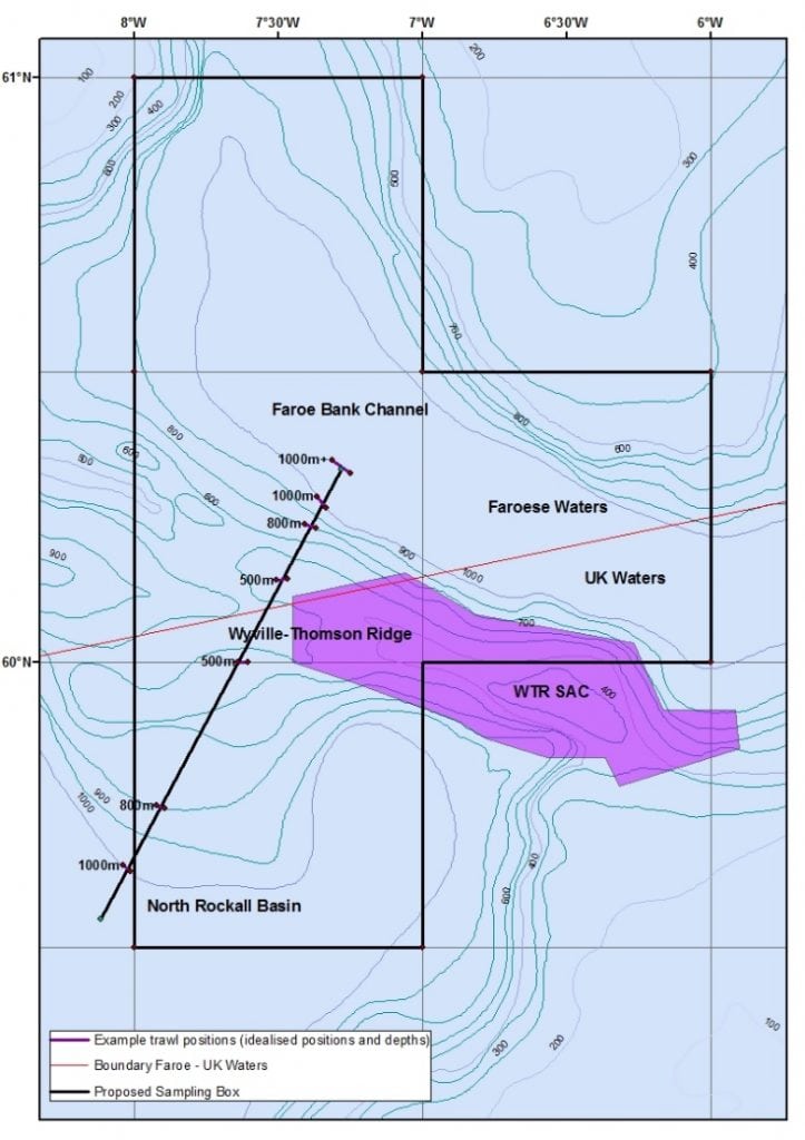
7. Measure rate and direction of long-term change (type one monitoring) using drop-frame fitted with high definition cameras.
8. Scope out and undertake a series of depth stratified trawls on suitable grounds to the west of the SAC taking in the North Rockall Basin, Wyville Tomson Ridge and Faroe-Bank Channel.
Additional Objectives:
9. Trial and assess performance of Aquatracker.
10. Obtain tissue of selected fish for barcoding.
11. Sample benthic fauna using Agassiz using trawl ground-gear bags in selected areas.
General:
The survey will consist of two legs:
- The first leg will consist of 12-hour shifts of visual survey using VMUX chariot and drop-frame interspersed with 12-hour shifts of trawling or other sampling. This leg will start at FSSB (projected duration four days), continue at RB (five days) then WTR (three days). Fishing and Agassiz trawl sampling operations will generally be carried out between 1200-2400 and camera work between 0000-1200.
- The second leg will consist of round-the-clock visual surveying with the drop-frame and will take place again at WRT (three days) and finally back to FSSB (four days).
Objectives 1, 4 and 7: In the FSSB the first TV transects will be made with the chariot. These will consist of 9 km runs; perpendicular to the depth contours within the 400-600 m depth range (where the sponges are expected to occur) to ascertain distribution and extent of the feature. A further set of 200 m runs will be made with the drop-frame, during the second leg, to provide high definition footage for species and density analysis.
At RB the chariot will again be used to clarify the distribution and extent of the sponge feature on the northern and southern slopes. Time permitting, other seamount communities may be targeted with the chariot. A further set of 200 m drop-frame runs will be made at the site of the 2014 ‘MoreDeep’ visual survey on the eastern slope of RB for high definition footage as above.
At WTR where this work is a continuation from that already achieved during cruise 1517S last year this objective will be met by 200 m drop-frame runs only.
Objectives 2, 5 and 8: Demersal trawl data will be used as baselines to assess the future status of the protected area. All demersal trawls will be away from sponge aggregations and other Vulnerable Marine Ecosystem (VME) habitats. Trawling will take place on stations in Faroe-Shetland Channel over a depth range of 300-1500 m. These will mainly be outside FSSB. However, two (providing times-series data) are inside. These are deliberately placed well away from the spongebelt and have historically negligible bycatch of VME indicator species.
At RB, demersal trawling will take the form of historical fixed stations which provide important time-series data and which again have historically demonstrated little or no VME bycatch. A potential new site to begin a depth-stratified time-series data will be sought out to the west of WTR; this will include hauls on suitable sediments in the Faroe-Bank Channel (Faroese waters), Wyville-Tomson Ridge, and North Rockall Basin. Map 2 shows an idealised version of how these trawl sites may look. Reality will depend on what sites are available to trawl.
All demersal haul durations are expected to be a maximum of 30 minutes. The ground-gear net will be attached and deployed on an opportunistic basis during demersal trawling to obtain samples of the invertebrates.
Objectives 3 and 6: Short (nominally three minute) hauls with 2 m Agassiz trawl will be undertaken in FSSB and RB to obtain samples of the sponge community. Trawls will be away from areas of type one monitoring.
A summary of expected demersal and Agassiz trawl deployments is presented in Table 1.
All fish species will be identified, weighed and measured. Invertebrate species will be identified and counted and/or weighed.
During leg 1 the Aquatracker and large Van Veen Grab will be deployed on an opportunistic basis.
Gear (Full Survey):
- VMUX towed video chariot with HD camera system and integrated CTD (Conductivity/temperature/depth logger);
- Drop-frame with HD camera system and integrated CTD;
- Ranger 2 USBL positioning system; and
- Large Van Veen grab.
Gear (Part 1):
- 2 x Jackson BT 184 bottom trawl;
- 2 x ground-gear bag nets (centre section only);
- 2 x pairs Morgere ovalfoil trawl doors;
- 2 x Agassiz benthic sampling trawl;
- Scanmar trawl sensors;
- Bottom contact sensor;
- Conductivity/temperature/depth logger (CTD DST logger); and
- Aquatracker.
Gear (Part 2):
- 2 x 0.1m2 Hamon grabs;
- 1 x 0.25m2 Hamon grab; and
- Large Van Veen grab.
Chemicals:
- Ethanol;
- Formaldehyde;
- 10% Formo-saline; and
- Borax.
Further Information:
- Previous MSS Research Survey Blogs
- Joint Nature Conservation Committee (JNCC)
- Latest news from JNCC staff out on survey
- MRV Scotia location – Where are they now?
Tags: demersal trawling, Drop-frame, Faroe-Shetland, MoreDeep, MPAs, Rosemary Bank, Special Areas of Conservation, Wyville Thompson

Leave a comment