
Marine
Demersal Trawling with the Scotia
February 17, 2020 by Marine Directorate Communications No Comments | Category Marine Directorate general, Marine Directorate Science, Research Vessel Surveys

MRV Scotia Programme
Survey: 0320S
Duration: 16 February – 9 March 2020
Objectives:
- Demersal trawling survey of the grounds off the north and west of Scotland in ICES Subarea 6a.
- Obtain temperature and salinity data from the surface and seabed at each trawling station.
- Collect additional biological data in connection with the EU Data Collection Framework (DCF).
- Retrieval and re-deployment of COMPASS moorings located at discrete sites within the survey area.
Procedures:
General: A training haul will be undertaken during the passage north to ensure all fishing gear/sensors are working effectively. Scotia will then commence fishing operations the next morning on predefined stations off the north Scottish coast and west of 4’W with weather conditions thereafter determining the route taken on the survey.
Trawling: This is a random-stratified survey design with trawl stations being distributed within 10 predefined strata that cover ICES subarea 6A (see figure 1). A total of 62 primary and 45 secondary stations have been generated. The intention is for the 62 trawls to be undertaken on suitable ground as near to the primary station as is practicable.
Hauls will be of 30 minutes duration unless circumstances dictate otherwise. Where possible, fishing operations will be restricted to daylight hours. In addition to the routine sampling, biological data and samples will be collected for target species in line with the EU data regulation and other external projects.
Hydrography: A Conductivity, Temperature and Depth (CTD) cast will be taken at each trawl station, weather permitting. Top and bottom temperatures will be reported and in addition, a calibration sample will be retained from the surface.
Compass Moorings: Six acoustic moorings were deployed at sites within the 0320S survey area during the second half of 2019. Two days have been allocated from this survey in order to retrieve and redeploy these.
An acoustic release system will be deployed from the vessel to trigger each mooring; this allows the mooring to surface, where it can be retrieved then re-deployed again.

Figure 2: 0320S – Location of Compass moorings
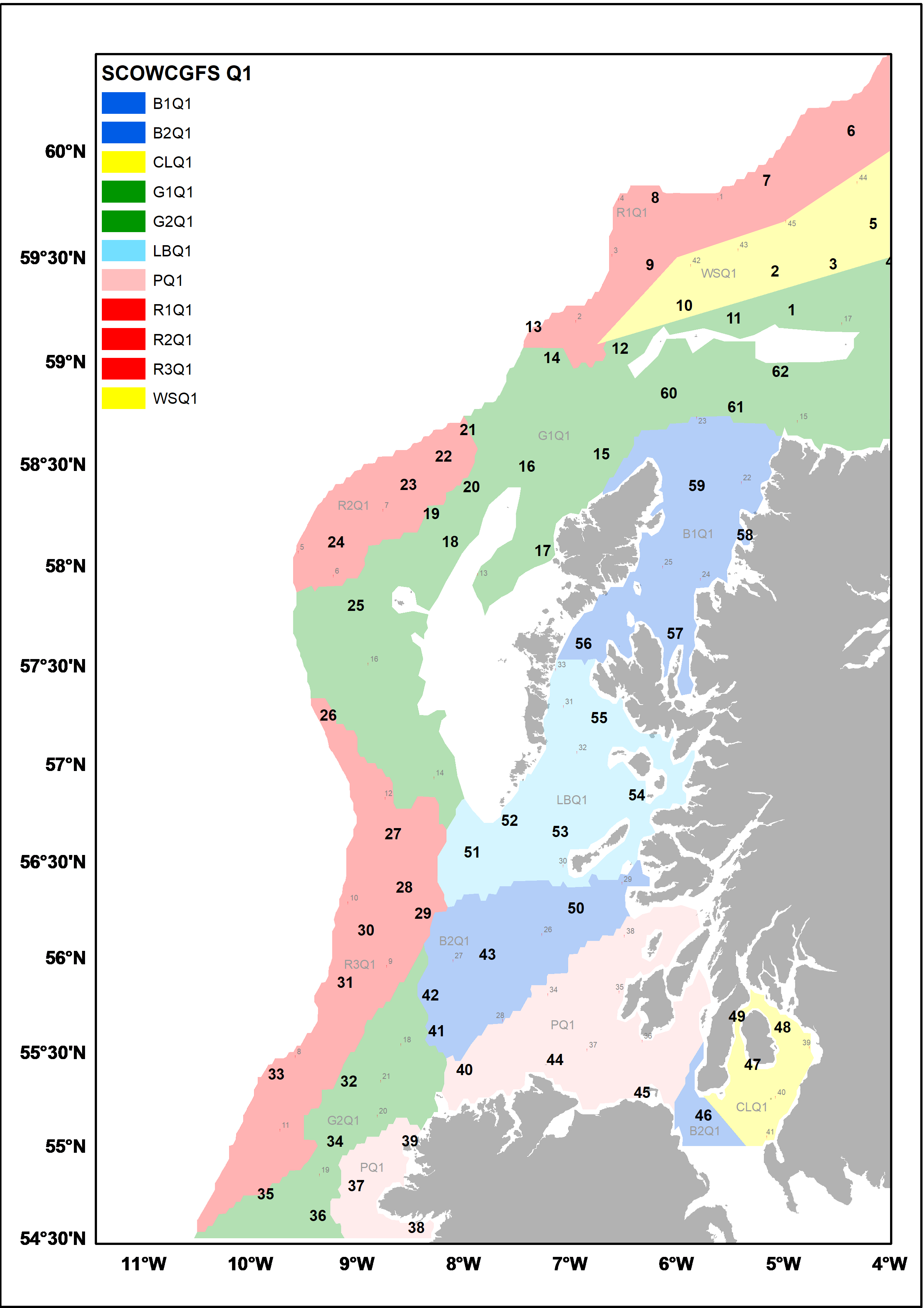
Figure 1. 0320S (SCOWCGFS-Q1) – 2020 ICES Subarea 6a Survey Strata showing primary (bold face) and secondary trawling stations (red dot – plain face).
Further Information:
- International Council for the Exploration of the Seas (ICES)
- MRV Scotia on Flickr
- COMPASS Project Website
Tags: COMPASS, fisheries, fishing, ICES, International Council for the Exploration of the Sea, MRV Scotia, research, science, Scotia, Survey, trawling

Leave a comment