
Marine
Detecting Weekly Changes in our Oceans using Seagliders
February 28, 2020 by Marine Directorate Communications No Comments | Category Collaborations, Marine Directorate general, Marine Directorate Science, Publications, Research Vessel Surveys

Marine Scotland Scientists have been involved in a series of three ocean glider data set peer-reviewed articles. The latest, titled ‘Weekly variability of hydrography and transport of northwestern inflows into the northern North Sea’ has recently been published in the Journal of Marine Science.
Collaborating with researchers from the University of East Anglia, colleagues from our Oceanography group used our marine research vessel MRV Scotia to deploy an underwater autonomous glider, called a Seaglider, to collect underwater observations in the northern North Sea.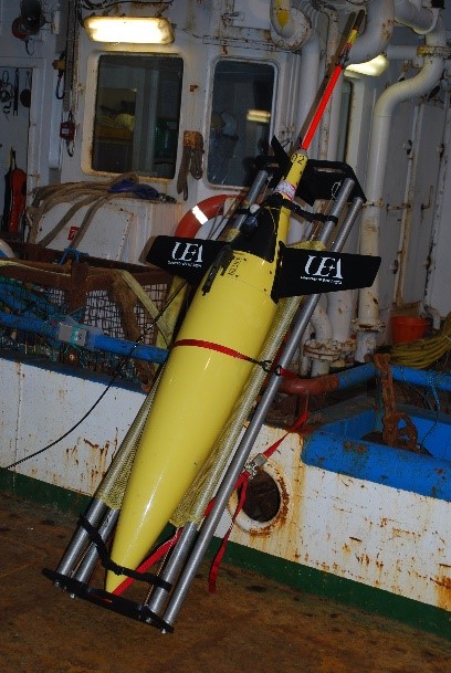
This region is of great interest as coastal waters that flow clockwise around the Scottish coast and waters from the Atlantic Ocean enter the North Sea here. During summer time, parts of the northern North Sea also stratify when heat input from the sun is not fully mixed throughout the water column, and instead creates a layer of warmer water, near the sea surface. A thermal mixing front occurs where there is a transition from the stratified waters to those where the sun’s heat input is mixed throughout the water column all year round.
The deployment was part of the Brahan Project; an initiative led by Marine Scotland Science (MSS) to measure the speed and direction of ocean surface currents on an hourly basis and provide information about wave parameters as well.
In addition to the Seaglider observations previous measurements collected by MSS were also used by collaborator and lead author Peter Sheehan.
Analysing the Northern North Sea
During this work, Peter collected observations across an area of the northern North Sea and the analysis showed that salinity and water mass distribution are important controls on the location of the front, as well as surface heat input and mixing by tidal currents.
In the final of the three publications, Peter’s work analysed the two-month glider deployment to describe water mass properties and volume transport at a high spatial and temporal resolution (Sheehan et al., 2020). Traditionally, observations are collected three times per year during hydrographic surveys aboard MRV Scotia. The ocean glider occupied a significant part of the Joint North Sea Information System (JONSIS) section 10 times in two months.
The Seaglider is capable of collecting observations at a much finer scale than ship-based surveys and has highlighted the occurrence of several, strong narrow currents. These finer-scale patterns are important to understand the transport of water, and all of its contents (such as heat, salt and microscopic organisms), into the northern North Sea. Which can, in turn, provide additional context to the long-term monitoring that characterises the prevailing physical conditions in the area and how they change as a result of natural processes and a changing climate.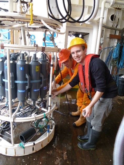
Peter (shown right) is continuing his work with ocean gliders at the University of East Anglia, but is now using glider data to investigate water mass composition and air-sea interactions in the warmer waters of the Bay of Bengal.
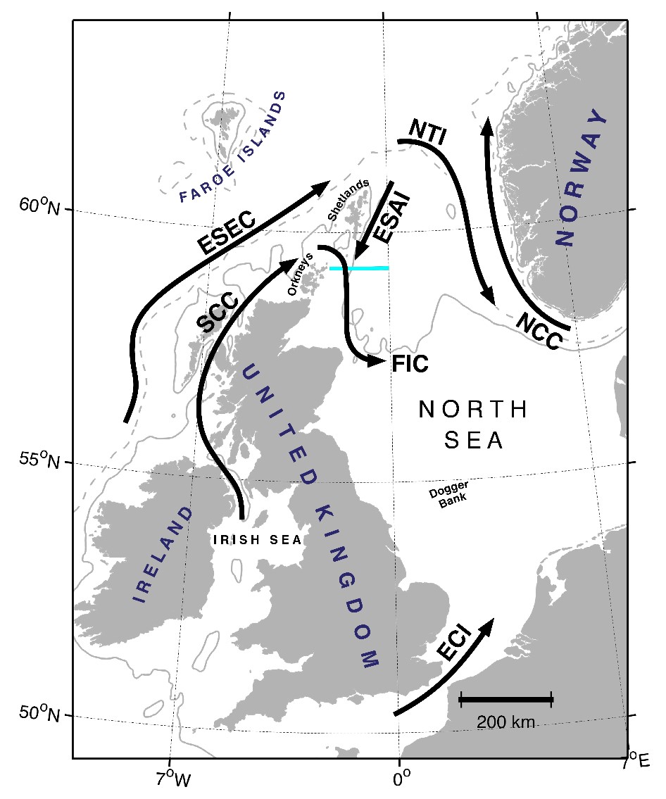
Map of the North Sea. The location of the JONSIS line (cyan) and the approximate paths of the Fair Isle Current (FIC), East Shetland Atlantic Inflow (ESAI), Norwegian Trench Inflow (NTI), Norwegian Coastal Current (NCC) and English Channel Inflow (ECI) are shown. From Sheehan et al. (2020).
Further Reading:
- More information on the Braham Project
- Sheehan, P. (2019) Forcing and variability of northwestern inflows into the northern North Sea. Doctoral thesis, University of East Anglia.
- Sheehan, P., Berx, B., Gallego, A., Hall, R.A., Heywood, K.J., Hughes, S.L. (2017) Thermohaline forcing and interannual variability of northwestern inflows into the northern North Sea. Continental Shelf Research.
- Sheehan, P. M. F., Berx, B., Gallego, A., Hall, R. A., Heywood, K. J., Hughes, S. L., Queste, B. Y. (2018) Shelf sea tidal currents and mixing fronts determined from ocean glider observations. Ocean Science.
- Sheehan, P. M. F., Berx, B., Gallego, A., Hall, R. A., Heywood, K. J., Queste, B. Y. (2019) Weekly variability of hydrography and transport of northwestern inflows into the northern North Sea. Journal of Marine Systems.
Tags: autonomous glider, climate change, environment, hydrography, Joint North Sea Information System, JONSIS, marine science, MRV Scotia, North Sea, northern North Sea, oceanography, science, Scotia, Scottish, Seaglider, Survey, tidal, University of East Anglia

Leave a comment